
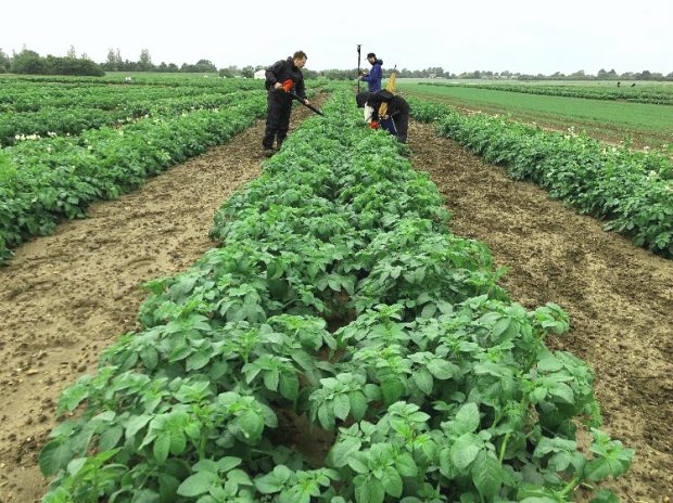
Donning wellies and with clipboard in hand, an inspector sets out on an early summer morning for a full day of walking row upon row, back and forth through countless potatoes, ever vigilant for that rogue or diseased looking plant. After many days, a few blisters and step counter clocking over 20,000 steps per day, the growing season inspection is complete and the quality of the crop assessed.
In a different part of the country, another inspector stretches their neck peering through binoculars for an elusive quarantine pest infestation high in the tree canopy. What if there was a more effective and time saving tool that could cover the miles, and help visualise difficult to reach areas? Bring in the drone!
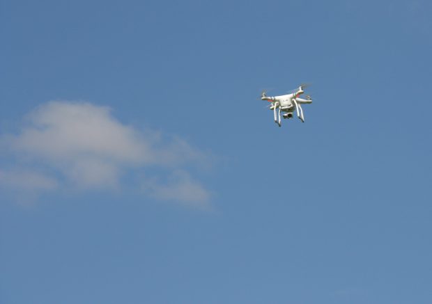
Drones, or unmanned aerial vehicles (UAVs), can be skillfully flown up and down countless rows of potatoes from a fixed location, or high above the tree canopy in inaccessible areas for inspectors to reach, all the time delivering high resolution images for the pilot to view and record any of the pest and diseases or rogue plants the inspector is hunting out.
This blog sets out how the use of this technology could help the plant health and seeds inspectors with some of their inspection duties.
Plant Health and Seeds Inspectorate (PHSI) role in APHA
Rapid detection of plant pathogens is critical in preventing widespread epidemics that can impact our environment, economy and social well-being. Early detection of new instances of plant pest and disease can make the response more manageable, reducing the impact of an outbreak. Early intervention can also reduce the cost of any containment or eradication activity.
The varied and complex nature of plant pests and disease means that visible symptoms can take time to develop after the initial infection resulting in plant pathogens being undetected for long periods of time. One of the ways that new technology can help us is by capturing and analysing aerial imagery to identify new disease outbreaks earlier, allowing for a swift, targeted response.
New technology
Farmers have started to use unmanned aerial systems (UAS) and aerial imagery to manage their land more effectively. An UAS describes the whole system that includes the drone or UAV, the ground-based ‘pilot’ and the system of communications between them both. This technology allows farmers to gain oversight of nutritional or protection requirements of crops, potentially saving them time and money by allowing for precision applications of chemicals, fertilisers or crop irrigation. Multispectral and hyperspectral imagery are often used to measure the responses of plants in the visible and near infrared parts of the electromagnetic spectrum to remotely detect plant stress.
The project
Evidence has shown that remote imagery can help to identify disease related stress in plants, but could the spectral signatures of infected plants be unique enough to differentiate the causal disease remotely? And how could we use this to reduce the burden on inspectors in the field or better target our inspections? Last year, we started a Defra funded project using seed potatoes as a model system, working with Fera Science Limited to attempt to answer these questions and more.
Every year dozens of inspectors walk mile after mile of potato fields to verify varieties are true to type and searching for the symptoms of virus and disease by eye before crops can be certified for sale in the EU. In the North East, where more than 60% of England and Wales’s seed potato production occurs, covering well over 2000 hectares, this means thousands of miles are walked during an intensive two-month period every summer.
When disease symptom thresholds are reached by certain viral and bacterial diseases this impacts on the grade of seed potato produced. This is an ideal scheme to test the use of UAS for disease identification to check if UAV mounted cameras had the potential to reduce the burden on our field inspectors certifying crops either through reducing or better targeting inspections.
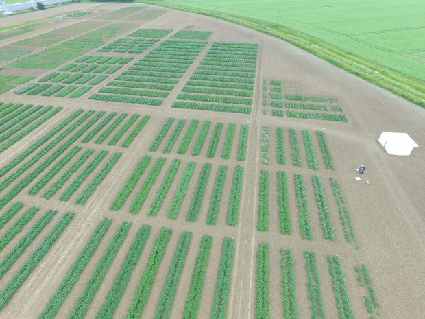
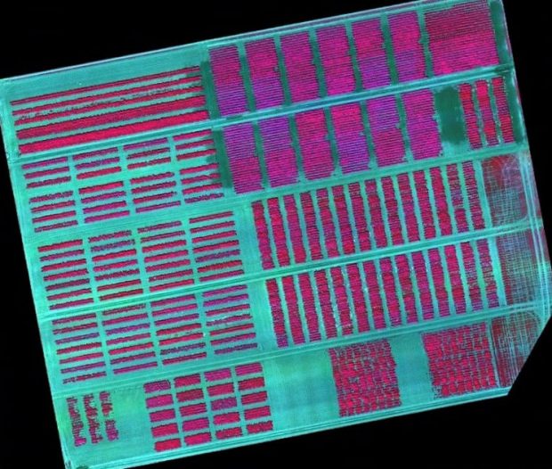
Over the last two seasons, visual, multispectral and thermal data was collected at the APHA potato trial plots at the National Institute of Agricultural Botany (NIAB) in Cambridge. The plots are sown with the top 25 most widely grown varieties, some already inoculated with disease and used to train our inspectors to do visual inspections. This presented an opportunity to develop a training dataset to develop our image analysis.
Much of the aerial imagery was collected alongside visual assessments on the ground by APHA inspectors to compare what the inspectors and the camera sees. Additional laboratory testing may also be able to tell us whether the camera picks up any disease infected plants before they are symptomatic. The use of multispectral and hyperspectral cameras will, we hope, get us a step closer to remote inspections reducing the burden on inspectors.
Further ‘real world’ data was collected by working with local farmers, involved in the national certification scheme, at six seed potato fields in the Yorkshire Wolds, to further test our work.
The data is only just beginning to be analysed but our initial visual analysis of the imagery data showed that varietal differences were readily identifiable and, promisingly, disease presence could be visually detected in the data with the potential for early detection of disease stress even before visible symptoms became apparent!
Although this work focused primarily on viruses in potatoes, the research and methodology we are developing in this project has implications for remote detection of a range of pests and pathogens across multiple plant hosts. We hope this work, when complete, will strengthen the evidence that thermal, multispectral and hyperspectral imaging can not only allow better targeting of inspections but can also be used in the early detection of plant pest or disease challenges.
Report suspicion of a quarantine plant pest or disease
To report suspicion of a quarantine plant pest or disease or for advice and guidance on plant health regulations call our plant health helpline on 01904 405 138 or email planthealth.info@apha.gov.uk.
Enjoyed reading? Then why not subscribe to the APHA Science Blog
2 comments
Comment by Huw Thomas posted on
Interesting and very worthwhile exploratory use of technology, especially if it does prove to be entirely practical and highly reliable for earlier detection of disease. Good luck with this.
Comment by Anthony Walker - DEFRA posted on
Interesting study! I'd be interested to know if it has been considered that the data analysis could be approached using machine learning image classification? Alongside drone automation, this could helpfully 'hands free' much of this operation.